The United Nations General Assembly voted on Friday, 4 September 2026, to abandon the 16th-century Mercator map in favour of a modern projection that reflects the true physical scale of Africa. In a plenary session at UN headquarters in New York, 164 member nations backed a resolution promoting the Equal Earth projection to replace the distorted chart devised in 1569 by Flemish cartographer Gerardus Mercator. The United States cast the sole dissenting ballot, while six countries chose to abstain. Togo sponsored the measure on behalf of the African Union, building on the grassroots Correct The Map campaign. Diplomats cheered the outcome as a major victory against cartographic distortion. Flawed geometry has shaped global politics for centuries. The world assembly finally chose to accept physical reality.
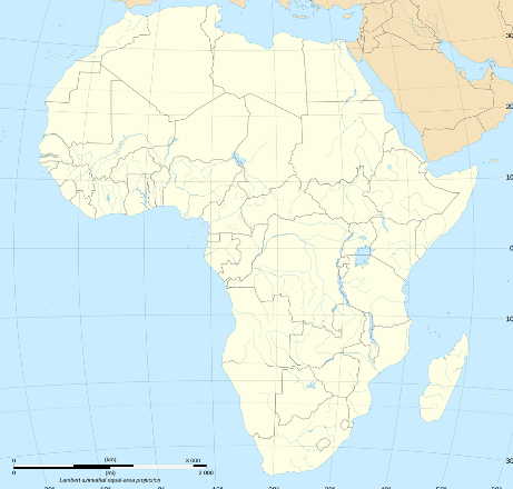
The Mercator projection solved an urgent technical headache for Renaissance sailors who needed straight compass bearings to navigate oceans. That navigational utility came at a punishing visual price for equatorial lands. Because the projection stretches latitude lines toward the poles, it magnifies landmasses in the far north while compressing the middle of the globe. Under this model, Greenland appears roughly equal in area to the African continent. In cold physical fact, Africa is fourteen times larger than Greenland. A cartographer could pack the United States, China, India, Japan, Mexico, and most of Europe inside Africa with land to spare. Flemish sea charts turned a vast continent into a modest landmass.
The political consequences of this geographic distortion run deep into international diplomacy and development planning. By shrinking Africa on classroom walls, the traditional map encouraged Western policymakers to treat the continent as a marginal territory rather than an enormous landmass. Togolese Foreign Minister Robert Dussey told the assembly that the debate concerned hard science rather than partisan ideology. He pointed out that maps shape mental habits, cultural assumptions, and the distribution of global capital. European capitals appeared vast and imposing on schoolroom walls while equatorial nations looked small. Shrinking a continent on paper helped colonial empires diminish its people. Power dynamics often hide behind standard classroom charts.
Cartographers created the Equal Earth projection in 2018 to solve the visual distortions of older models without creating ugly shapes. The modern design keeps the relative surface areas of all continents accurate while preserving familiar land outlines. The African Union endorsed the system in August 2025 before asking Togo to lead negotiations at the UN. France broke ranks with other Western powers by co-sponsoring the resolution and agreeing to dump the Mercator model in state offices. French Foreign Minister Jean-Noel Barrot noted that correcting visual distortions constitutes an essential act of truth. Paris wants to mend frayed ties across former African colonies through diplomatic concessions. Changing the map provides cheap diplomatic capital in West Africa.
The lone American vote against the resolution drew sharp scrutiny across the diplomatic corps. Washington argued that the United Nations should not spend time dictating cartographic standards to private textbook printers and navigation desks. Yet that resistance leaves the White House looking isolated on a straightforward matter of geographic accuracy. The abstentions came from Eastern European states, including Ukraine, Moldova, Georgia, and Serbia. Many of those governments chose to sit on their hands to avoid offending their American security guarantors. The voting tally shows that multilateral diplomacy can still challenge Western dominance. Solitary vetoes look hollow when 164 nations stand united.
The non-binding nature of the UN resolution means that change will depend on private software companies and education ministries. The Togolese government plans a major summit in Lomé with UNESCO, the African Union, and technology giants like Google during the first quarter of 2027. African leaders want commercial digital mapping services to adopt equal-area projections on mobile phones and internet browsers. Most online mapping programmes still rely on Mercator variants because the grid simplifies digital tile calculations. Convincing Silicon Valley programmers to rewrite their base code will require persistent political pressure. Commercial code moves far slower than diplomatic speeches. Digital platforms must now match the physical reality of the Earth.
Adopting a true-scale map will not build a single paved road or clear rural debts across the African continent. Yet changing the visual terms of debate removes a subtle mental handicap that has persisted for four hundred and fifty years. A fair representation reminds foreign investors of the immense physical space, mineral reserves, and urban markets that define modern Africa. The resolution gives African diplomats a stronger psychological footing when demanding seats at the UN Security Council and the G20. Seeing the true scale of the land helps citizens understand their strategic importance in world trade. True maps cannot cure poverty alone. Honest geography provides a solid foundation for self-respect.