
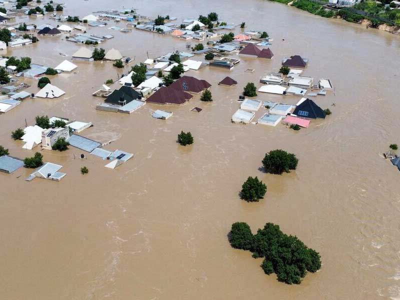
The Federal Government has placed 24 states and the Federal Capital Territory on alert for flooding between 27 September and 10 October 2026, following forecasts of heavy rain, saturated soil, rising river levels and increased surface runoff.
According to the advisory, the warning came from the National Flood Early Warning Systems Centre, which sits under the Erosion, Flood and Coastal Zone Management Department of the Federal Ministry of Environment. It was signed by the department’s director, Usman Abdullahi Bokani.
The centre sorted the affected communities into three bands, Critical Risk, High Risk and a Moderate Risk Watchlist, according to their expected level of exposure over the two week window.
States with communities in the Critical Risk band are Benue, Kogi, Kwara, Niger, Adamawa, Bauchi, Taraba, Rivers, Edo, Delta, Cross River, Bayelsa, Akwa Ibom, Abia, Anambra, Ebonyi, Enugu, Imo, Ekiti, Lagos, Ogun, Ondo, Osun and Oyo. The advisory listed riverine and coastal communities in Rivers, Delta, Bayelsa, Cross River and Akwa Ibom among the most exposed.
The FCT was placed in the High Risk band. Abuja Municipal, Asokoro, Bwari, Garki, Gwagwalada, Gwarinpa, Kubwa, Kuje, Kwali, Lugbe, Maitama, Nyanya and Wuse were among the Abuja locations named.
For Critical Risk areas, the centre urged residents to keep an immediate flood watch, confirm their evacuation routes and protect vulnerable people and essential property. It also warned people against settling, parking, trading or storing goods on floodplains, wetlands, riverbanks and low lying drainage corridors.
For High Risk areas, it advised authorities and residents to step up drainage clearance, monitor culverts and watercourses, and report heavy rainfall, waterlogging, dam releases and rising river levels. Across all the listed areas, it asked residents to follow evacuation instructions, keep children away from floodwater, and avoid walking or driving through moving water.
The bulletin is the latest in a run of warnings this month, and it points to a season that agencies had flagged well in advance. The Nigeria Hydrological Services Agency had, in a national advisory issued on 18 September, forecast high riverine flooding across 15 states between 19 and 25 September, with its director general, Umar Mohammed, warning that schools, hospitals, markets, farms and places of worship in floodplain communities were at risk.
Those warnings rest on the agency’s 2026 Annual Flood Outlook, which identified 14,118 communities across 266 local government areas in 33 states and the FCT as high risk zones, and named the stretch between July and September as the most dangerous. The outlook also flagged a possible second period of serious flooding between October and November.
The states now under alert are, for the most part, the familiar ones. The centre’s list runs along the Niger and Benue river systems and down through the Niger Delta, the same corridors the hydrological agency has pointed to year after year.
The stakes are set by recent history. The 2022 floods, Nigeria’s worst in over a decade, killed 662 people and displaced 2.4 million, according to figures given by the National Emergency Management Agency. In 2024, NEMA data as of mid September recorded about 1.6 million people affected, 634,035 displaced and 94,741 houses destroyed or submerged, with 176 local government areas in 30 states and the FCT hit.
Casualty and displacement figures for Nigerian floods should be read with some care. Counts compiled from state emergency agencies and international bodies have at times run well above NEMA’s own verified totals for the same season, and the gap between the two is a recurring feature of the reporting rather than a settled number.
The warnings also arrive against a season the agencies said could match or slightly exceed 2025. A United Nations anticipatory action framework for Nigeria recorded that the 2025 floods affected more than 400,000 people across 25 states and killed 232.
What the current alert confirms is a forecast, not an event. The centre has set out where the risk is highest and what residents and authorities are advised to do. Whether flooding materialises, and on what scale, will depend on rainfall through the period and on how far dam releases and river levels move over the coming days.
Much now rests on how quickly state and local authorities act on the warning. NEMA officials have repeatedly stressed that preparedness must come before disaster rather than after, but the agency depends heavily on state governments, many of which have limited emergency funds and weak channels for passing alerts down to rural communities. The next fortnight will test how far this year’s forecasts translate into action on the ground.